
FAA: How to Navigate UAS Facililty Maps
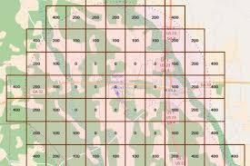
UAS Facility Maps show areas and altitudes in controlled airspace around airports where drone pilots can receive an authorization to fly below the maximum altitude depicted on the map, and up to 400 feet. In this webinar, #FAAAirspaceGuy Langston Majette explains everything you need to know about UAS Facility Maps. Access the UAS Facility Maps through our data visualization tool here: https://udds-faa.opendata.arcgis.com/